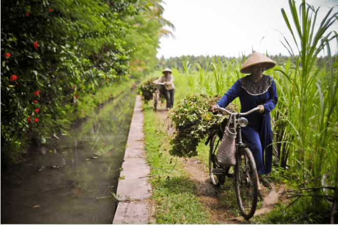
A technology used to map the surface of the moon during the 1971 Apollo 15 mission has landed in Indonesia and is proving to be a game changer for farmers needing better irrigation.
Called LIDAR for short, the light detection and ranging technology was piloted in Indonesia to provide high-resolution scans of irrigation systems, canals, and rivers to help farmers get better access to water supplies to grow their crops.
What is LIDAR?
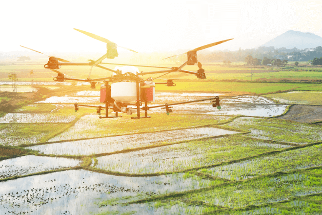
Based on laser technology, LIDAR works by using laser pulses beamed from the air, via airplane, helicopter, or drone, to scan and map objects on the ground. A version of the technology called bathymetric LIDAR can also “see” under water of up to 60 meters deep.
The resulting data, drawn from how fast the light travelled back to the LIDAR sensor, is then used to make detailed digital maps of the subject, in this case, irrigation systems in the Wadaslintang area in the Kebumen and Purworejo districts of Central Java Province. The area covers about 6,000 hectares, including rivers and canals.
The Asian Development Bank (ADB) piloted the project in 2017 in coordination with the Indonesian government. The project was funded through the Netherlands Trust Fund under the Water Financing Partnership Facility.
ADB Senior Water Resources Specialist Eric Quincieu says the technology and the data provided would allow the government to provide irrigation where it is needed most and to manage resources better.
With food security poised to become an issue in Indonesia, the country needs to improve its irrigation since only a portion of the system is functioning at full capacity. This in turn, limits yields and curbs livelihood of the rural poor.
A case for LIDAR
For Quincieu, the project officer, LIDAR is a game changer. The technology did in just a matter of days survey work that would have taken “months and months” the old-fashioned way with people doing the actual surveying, he notes.
Doing survey work the conventional way is a huge challenge because Indonesia has 7 million hectares of irrigated land.
With LIDAR, surveying large areas can be done in a very short amount of time.
ADB thought of streamlining the process by using technology, including drones and satellite imaging. “While very useful, it was not giving us the same definition, the same accuracy that we need to define the exact position of the canals and the structures as LIDAR,” Quincieu says of satellite-based technology.
Since LIDAR could detect features not visible to the naked eye or standard photography, it provided a more accurate picture of the state of the canals, ditches, and other water bodies, as it could see objects under water, and assess the state of riverbeds and seafloor.
The data provided in turn could help in engineering design and planning of irrigation systems and manage water consumption, Quincieu cites. “And of course, it's cheap and very accurate.” Depending on the size and complexity of the project, the cost of LIDAR surveys and the data processing involved could range between $10 and $15 per hectare on average.
‘We can almost see flies’
For the project, the LIDAR sensor was rigged onto a Cessna airplane. The survey consisted of airborne topography, as well as digital air photo and ground survey for field assessment and validation of the LIDAR data. The equipment used was so high-powered, it picked up so much detail, Quincieu recalls, joking, “We can almost see flies.”
Having worked in water resources management in the Asia in the Pacific for the past 20 years, Quincieu is keen to see how else the technology can be applied in the field, including watershed and coastal management.
While LIDAR has been used in Indonesia to survey palm oil plantations, the project is the first time the technology was used to survey irrigation and water systems. But the technology has been used extensively in other countries. In Japan, LIDAR has been used to monitor rivers and shorelines.
Quincieu points to advances in technology, including artificial intelligence, the internet of things, as well as better computing capacity for the wider use of the technology in different fields.
When asked whether the results of the project justify using it for other ADB projects, he replies, “That’s a no-brainer. There are projects in the works already where LIDAR is going to be used. We have around 15 sub-projects that are being prepared for irrigation and flood management and they are using LIDAR.”
Not bad for a technology first developed in the 1960s.