Damage from floods and other natural hazards in two major river basins in Mindanao is estimated at $61.6 million annually and puts thousands of lives at risk. The Philippine government has turned to nature-friendly solutions that respect river dynamics and ecosystem functions to reduce damage and keep vulnerable communities safe.
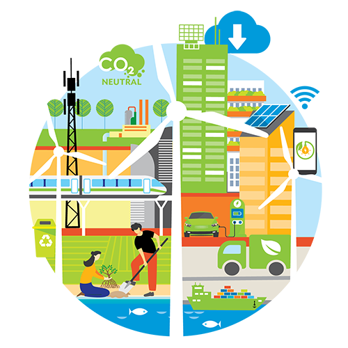
Nature-based solutions leverage on the intrinsic abilities of natural river systems to deliver climate resilience at a lower cost than traditional infrastructure development while minimizing negative environmental and social impacts. The approach is science-based and follows the principles of participatory water resources management. Solutions include planting mangroves, restoring wetlands, and building bioswales.
The Philippines is now piloting the nature-based approach in Mindanao’s Buayan–Malungon and Tagum–Libuganon river basins to mitigate flood risks in vulnerable communities. The project, which is supported by the Asian Development Bank, is also being piloted in two other river basins in Luzon and Visayas. The government hopes the project could serve as models for potential replication and upscaling in other river basins in the country.
Buayan–Malungon river basin
The river basin flows through the provinces of Davao del Sur and Davao Occidental in Region 11 and Sarangani and South Cotabato in Region 12. Most of the land is cultivated with perennial crops and covered by grasslands. The river basin has 5.6% forest area.
There are at least 299,679 inhabitants in the river basin. The local population is expected to increase to 2.1 million by 2050. Residents depend on agriculture as their main livelihood, but poor water supply has forced them to adopt other sources of income, such as charcoal making and logging. The sediments deposited into the river amass in the low slopes of the middle and lower basins where the river meanders and attracts uncontrolled quarrying, affecting the river’s geomorphology.
Annual flooding poses a serious risk to about 39,000 individuals and causes an estimated $22.6 million in damages. Other common natural hazards are droughts, earthquakes, and landslides.
The challenge. An assessment of the problem areas indicated the downstream area, the flattest and most populated part of the basin, as the most in danger based on the combination of hazards, such as river and coastal flooding, waterlogging, and soil erosion. The floods are concentrated in the river mouth and the junction of the Buayan and Maribulan rivers. High discharges can cause floods lasting up to 6 hours in Barangay Buayan and Barangay Baluntay. Existing infrastructure, such as the Old Buayan Bridge downstream and the new Buayan bridge upstream, further worsens flooding.
Proposed solutions. The Department of Public Works and Highways proposed a “room for the river” approach to control high water levels during floods and restore the natural landscape. This will involve demolishing the Old Buayan bridge and a dike to create more space for the water, construction of jetties on each side of the Buayan river to reduce impact from coastal flooding, drainage improvement, and the planting and/or restoration of mangroves to improve protection against coastal flooding. The construction of a natural bypass to reduce flooding and the protection of barangays that are most at risk were also proposed. The bypass reduces the pressure on the confluence of the Buayan and Maribulan rivers and will reduce flooding in that area.
The proposed solutions aim to reduce incidence of waterborne diseases due to floods, encourage recreation activities, create spawning ground for fish, and increase biodiversity in the river basins.
Authorities are also looking at resettling affected communities and elevating the road. In terms of resettlement, more intensive stakeholder involvement and consultations are needed to come up with interventions that benefit the affected communities.
Tagum–Libuganon River basin
This river basin is in Southern Mindanao and extends over Region 11, Region 13, and four provinces: Davao del Norte, Davao del Sur, Compostela Valley, and Agusan del Sur. Davao del Norte province lies almost entirely in the basin while the other provinces have only a minor part of their area in it. The forest area is estimated at 43%.
The basin has 824,155 inhabitants, which are estimated to increase to 1.443 million by 2050. Residents depend on aquaculture, agriculture (i.e., banana, rice), agroforestry, trading, and quarrying for their livelihood.
The challenge. Existing infrastructure, roads, and narrow culverts in the river basin have worsened flood problems for the municipality of Carmen, considered one of the growth centers in the basin. Regular flooding is reported in the area, especially in barangays Tuganay, Alejal, and Ising.
Improper land use, change in river morphology from natural factors, or man-induced activities such as quarrying, and the presence of structures and communities in flood-prone areas also contribute to the flood hazard. Improperly disposed wastes have also blocked river drainage channels. The basin also lies in a seismically active zone, adding to the hazards that face residents. Annual damage is estimated at $39 million.
Proposed solutions. Authorities have proposed a suite of solutions for the Tagum–Libuganon river basin. It includes restoring the Ising wetland in Carmen, building bridges and culverts in the road to accommodate peak runoff during 100-year events, comprehensive land use planning, and creating a green river-like connection between the Tuganay and Ising rivers. Connecting the two rivers can improve the natural quality of the Ising river and wetland, which is an area dominated by irrigated rice and banana plantations.
Reviving the Ising wetland can improve the river’s water quality and trap sediments to reduce soil erosion. This will store and slow down floodwaters that could protect downstream areas from destructive floods and protect the habitat of flora and fauna, which could serve as food for locals and support ecotourism activities like bird watching. With increased floral species, density, and volume, the wetland can help reduce pollution by sequestering carbon from the atmosphere.
The Ising wetland can also act as a buffer for excess rain. By soaking up excess water like a sponge, it can potentially reduce flooding in nearby areas.
The proposed solutions can also control waterlogging, river flooding, and erosion issues with land use planning and construction of traditional gray infrastructure like bridges and culverts.
Moving forward, soliciting the support of communities, agencies, and organizations is key in carrying out the proposed solutions.
This article was first published by BIMP-EAGA on 30 June 2022.