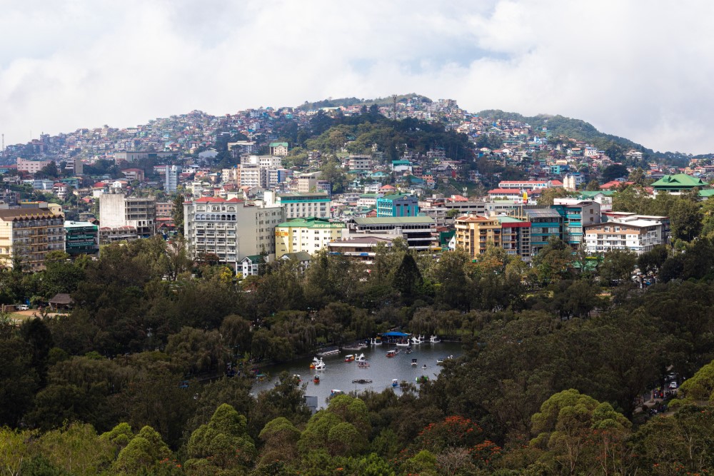
Located in the northern part of the Philippines, Baguio City is a popular highland retreat especially during summer because of its cool climate, pine forests, and diverse attractions. It is a bustling city that serves as a commercial, educational, and recreational center in the Cordillera and Northern Luzon regions.
However, the city does not enjoy mild weather all the time. It receives an average of five tropical cyclones a year and twice the volume of rainfall than Manila. Extreme rainfall triggers flooding in low-lying areas and landslides, making roads impassable and damaging infrastructure, houses, and commercial properties. Last year, the city was on the path of Super Typhoon Egay (known internationally as Doksuri) and was placed under a state of calamity along with other affected regions. More extreme weather events are expected because of climate change.
Like many cities around the world, Baguio faces problems linked with rapid urbanization, which increase its vulnerability to climate hazards. These include factors that contribute to and worsen flooding, such as the expansion of impervious paved areas, the encroachment of easement areas by settlements along waterways, waste accumulation, and limited drainage capacity.
A new vision
A study by the National Economic and Development Authority (NEDA) in 2019 found that the city is approaching its urban carrying capacity limit and risks urban decay by 2043. In response, the local government consulted stakeholders from different sectors and recently launched a new vision for the city that will put it on a sustainable development path. To prevent irreversible urban decay, Baguio will transform itself into “a creative, inclusive, and livable city.”
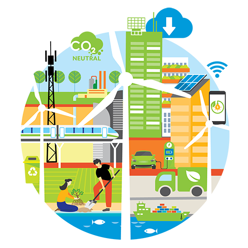
Improving climate resilience is key to achieving the city’s goals. A pilot project supported by the ASEAN Australia Smart Cities Trust Fund (AASCTF) worked with the city government and stakeholders to enhance flood risk reduction measures using holistic and inclusive approaches. AASCTF is financed by the Government of Australia and managed by the Asian Development Bank (ADB).
The project set up a smart flood early warning information system and real-time data capture system in four river basins in the city. It also prepared a flood mitigation action plan.
The final report of the Baguio City Smart Flood Early Warning, Information and Mitigation System Project summarizes the tasks, findings, and outputs. It also provides recommendations for the long-term sustainability of the flood early warning information system and the implementation of proposed plans and actions.
Data-driven solutions
The first task under the project was to map the baseline, identify data gaps, and provide the framework for project tasks. The baseline assessment provided inputs for the hydraulic modelling, hazard, and risk mapping; flood mitigation action plan; targeted capacity building and training program; gender and social inclusion study; flood early warning system; and data dissemination and outreach plan.
The results of the flood risk mapping showed that “more than 60% of the city is at risk of flooding (based on areas covered by low to very high risk).” It identified Balili, the main drainage catchment in Baguio, as the most flood-prone area with many houses, alleys, and roads exposed to flooding.
The findings and recommendations of the gender and social inclusion study guided the development of the flood early warning system to ensure that all stakeholders, including marginalized groups, are represented in the planning process and understand flood risk and their responsibilities.
Nature-based solutions
In developing the flood mitigation action plan, the project explored integrated, nature-based solutions for climate adaptation to not only improve flood mitigation but also maximize co-benefits, such as enhanced biodiversity conservation, increased recreational values, and improved quality of life. A toolbox of replicable and scalable solutions was developed based on the socioeconomic conditions and unique spatial context of Baguio. The city has a high building density and limited open spaces, which called for smaller interventions that could be connected throughout the city to mimic a natural system.
Eight typologies or solutions were developed with nature-based hydraulic functions (e.g., conveyance, retention, detention, treatment) to better manage stormwater flows, reduce flood risk, and improve ecological conditions. These are 1) stormwater park; 2) urban canal; 3) natural stream restoration; 4) green street; 5) stormwater boulevard; 6) livable corridor; 7) terracing; and 8) nonurban fringe buffer zone.
Three government-owned sites within the Balili catchment were selected to demonstrate how three different typologies may be applied: an urban canal near Manuel Roxas Street, a green street at Carino Street, and a stormwater park at Emilio Aguinaldo Park. Conceptual designs were made for these pilot sites. The proposed expansion of the urban canal, which is located on Balili River, is designed to reduce overflow from the river network during extreme rain events as well as provide spaces for nature and people, such as sitting areas, walkways, and a viewing balcony and amphitheater. The green street is envisioned as an extension of Burnham Park with vegetated ditches or bioswales for conveyance, detention and treatment of stormwater, recreational areas, and cycling and walking trail. The proposed stormwater park will be developed as a detention basin for rainwater. It is designed to increase recreational values by improving the site’s ecology and tapping into its historical value, educational potential, and proximity to a museum.