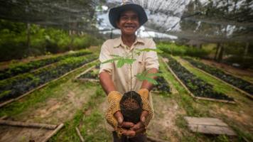
Farmers and stakeholders were trained on restoration techniques, erosion control, and ecological agricultural practices. Photo credit: ADB.
In Cambodia and the Philippines, farmers learn land restoration and ecological farming techniques to improve water and food security and for flood protection.
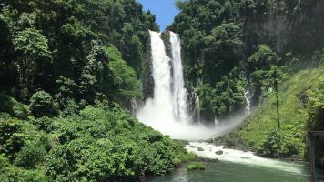
Healthy watersheds provide valuable ecosystem services, such as soil conservation and water retention and filtration. They support human and economic well-being and enhance climate resilience.
Watersheds, however, can degrade over time because of changes in precipitation patterns and temperature. Another major cause is poor land use, such as deforestation, overgrazing, and excessive tillage, especially on steep slopes. The deterioration of watersheds leads to reduced water resources, habitat loss, and increased risk of floods, landslides, and drought, affecting public health, livelihoods, and economic growth.
Further damage may be prevented through watershed rehabilitation and management. Experience shows that the required interventions are best carried out with the active participation of stakeholders.
An ongoing project supported by ADB and the Government of Japan through the Japan Fund for Prosperous and Resilient Asia and the Pacific is working with local communities to restore forest cover in upland watersheds in two countries in Southeast Asia. Forested watersheds decrease soil erosion by controlling the flow of water downstream and help maintain soil fertility. The project uses agroecology measures for landscape restoration in demonstration sites located in the headwaters of Sangker River Basin in Battambang province in Cambodia and Manupali River Basin in Bukidnon province in the Philippines.
Measures include reintroducing biodiverse vegetation and cropping to improve climate resilience and managing soil and water resources sustainably. Lessons learned from the project are expected to help advance efforts to rehabilitate the broader watershed and other watersheds in these countries.
Agroecological landscape restoration
The Food and Agriculture Organization of the United Nations (FAO) defines agroecology as “a holistic and integrated approach that simultaneously applies ecological and social concepts and principles to the design and management of sustainable agriculture and food systems.”
Agroecology is not new. Agroecological practices trace their origins to indigenous peoples’ food systems, which are now gaining attention for their environmentally sustainable practices.
Integrating agroecological principles into landscape restoration “empowers producers and communities as key agents of change.” This approach combines grassroots knowledge—traditional, practical, and localized knowledge held by farmers and farming communities—with science to address land degradation and improve food security through sustainable and socially inclusive solutions.
Critical watersheds in decline
Sangker is part of the western Tonle Sap River Basin group that drains much of the northern slopes of the Cardamom Mountains and flows into the Tonle Sap Lake, the largest freshwater lake in Southeast Asia. The headwaters of Sangker River are located in protected areas and flow through agricultural areas and wetlands to the Tonle Sap Biosphere Reserve.
The Sanker River Basin has a flat lowland region, which include internationally important wetlands, and a highland region toward the south and west of the basin. The area includes an extensive tropical rainforest known as the Samlaut Multiple-Use Area.
The lower basin has long been cultivated, and it is an important food producing area. The steeper hills of the upper basin have been cleared relatively recently for planting.
Studies show that forest loss and erosion in the headwaters have led to sedimentation in irrigation reservoirs and frequent flooding and drought in Battambang City.
Watersheds make up a large proportion of the total land base of the Philippines and provide vital resources for rural communities in upland areas.
Manupali is part of the Upper Bukidnon River Basin. It contributes to the Pulangi reservoir, which supports the largest hydropower facility in Mindanao.
The headwaters of the Manupali River are in the Mt. Kitanglad Range National Park, which is considered an important biodiversity reserve in the country. The river flows through agricultural areas downstream and supply a network of irrigation canals.
The Manupali watershed is considered Bukidnon’s food basket and supplies vegetables to other parts of the country. In the upper watershed, farmers produce maize, coffee, potato, cauliflower, cabbage, carrots, and other vegetables. Downstream, major crops include maize, sugarcane, and irrigated rice.
The forest area of the watershed has decreased significantly because of population pressures and agricultural expansion. Watershed decline has led to soil erosion, low crop yields, and higher incidence of flash floods and landslides.
A collaborative process
The project builds on ADB’s experience in implementing projects that have shown the development and environmental benefits of land restoration. These include work in the Upper Marikina River Basin Protected Landscape in Rizal province of the Philippines and the Greater Mekong Subregion, which includes Cambodia. ADB also supported the preparation of a Manupali Watershed Management Plan under the Integrated Natural Resources and Environmental Management Project.
For the agroecological landscape restoration project, ADB is working with Cambodia's Ministry of Environment and Forestry Administration and the Philippines’ Department of Environment and Natural Resources through the River Basin Control Office. The International Centre for Environmental Management (ICEM) and World Agroforestry Centre (ICRAF) are providing technical support to the project, alongside nongovernment organization (NGO) partners—Maddox Jolie-Pitt Foundation in Cambodia and Landcare Foundation of the Philippines.
Five demonstration sites were selected in the headwaters of the Sangker River Basin, with one site in the Samlaut Multiple-Use Area. Five demonstration sites were also set up in the headwaters of the Manupali watershed.
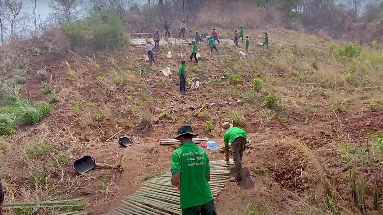
Forest and landscape restoration plans were developed by mapping and assessing the sites through a collaborative process. The project team consulted local stakeholders in selecting the sites for restoration. In the Sangker River Basin, the project prioritized community forests because their rehabilitation will benefit both the environment and the communities dependent on these ecosystems for their livelihood.
In the Manupali watershed, the demonstration farms are typical of vegetable farms on steep slopes at risk of soil erosion in the area. One site is within the Mt. Kitanglad Range Natural Park, another is in the park’s buffer zone, while the rest are in agricultural areas.
The project provided training on restoration techniques, erosion control, and ecological agricultural practices, such as structural soil and water conservation measures (e.g., soil bunds, terraces), using hedges and contour planting, and agroforestry. It also prepared a manual on good practices in biodiverse forest and landscape restoration.
The restoration plans are being implemented by the community with guidance from the local NGOs. The farmers received technical support in preparing and planting diverse native tree species and crops. They and other land users chose the species to be planted following ICRAF’s “the right tree in the right place for the right purpose” approach. Community nurseries were established to supply seedlings for forest restoration and provide a source of income.
The project also explored the use of advanced technology. Drones were deployed for aerial surveys and field observations to assess and monitor the sites.
The project has recommended the expansion of restoration work across the Sangker and Manupali watersheds for flood and drought management, sedimentation control, and improved water and food security as well as to promote sustainable livelihoods through ecological farming.
The solutions developed under the project are also replicable and may be applied to other upland watersheds in distress.